Hazardous Weather Outlook
National Weather Service Quad Cities IA IL
124 PM CDT Fri Jul 11 2025
This Hazardous Weather Outlook is for portions of north central
Illinois…northwest Illinois…west central Illinois…east
central Iowa…northeast Iowa…southeast Iowa and northeast
Missouri.
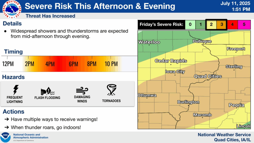
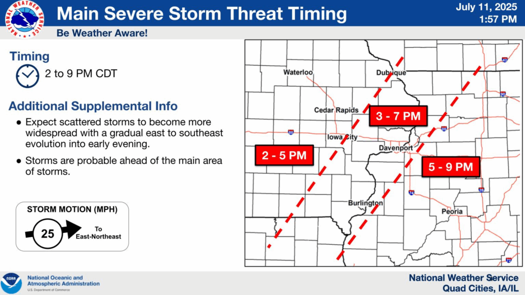
.DAY ONE…THIS AFTERNOON AND TONIGHT
Multiple rounds of thunderstorms are expected this afternoon
through the early morning on Saturday. An Enhanced Risk (Level 3
of 5) of severe thunderstorms is in place. Damaging winds and a
few tornadoes will be the main threats, with isolated large hail
being a secondary threat.
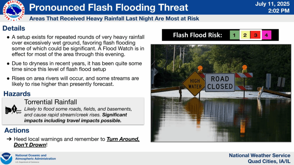
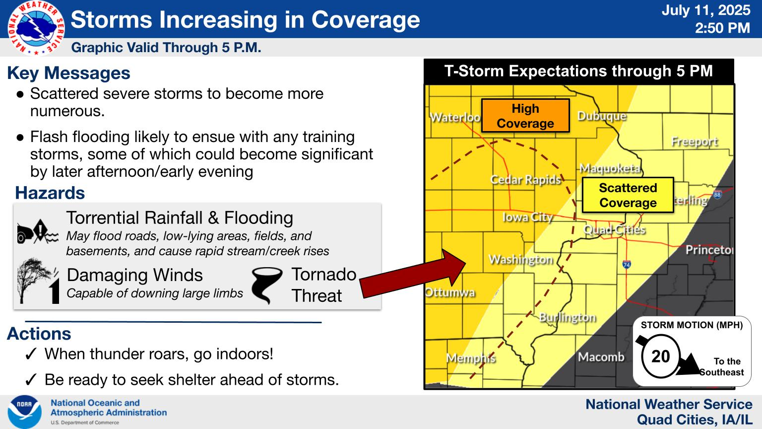
Flash flooding will continue to be possible across the area,
especially for areas that received heavy rainfall on Thursday, or
where multiple rounds of thunderstorms impact today.
.DAYS TWO THROUGH SEVEN…SATURDAY THROUGH THURSDAY
Isolated thunderstorms remain possible on Saturday, particularly
for areas along and east of the Mississippi River.