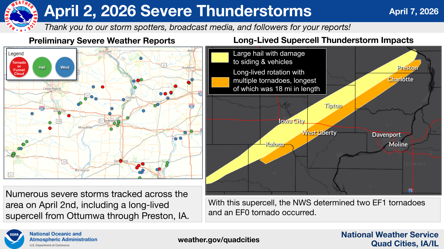
Preston, Iowa. The National Weather Service has completed its damage surveys from the April 2 severe weather event. Meteorologists found six tornadoes caused damage across the area, including an EF-1 tornado in Preston, Iowa.
The Preston tornado was the longest-track tornado of the day, with an 18.1 mile path from Welton, to Charlotte, up to Preston. The twister snapped ten utility poles, heavily damaged several out buildings and sheds. Shingles on homes were also damaged along the path.
Fortunately, no injures were reported out of any of the tornadoes. There were also many reports of hail and high wind gusts that day.
..FLOOD WARNING REMAINS IN EFFECT FROM LATE WEDNESDAY NIGHT UNTIL FURTHER NOTICE…
Moderate flooding is forecast for the Wapsipinicon River near De Witt IA. From late Wednesday night until further notice. At 12.0 feet, Overbank flooding occurs. Water affects residences along the river between Wheatland and Calamus. Water affects businesses along the river near Calamus. At 9:30 AM CDT Tuesday the stage was 10.7 feet. The river is expected to rise above flood stage early Thursday morning and continue rising to 12.0 feet early Sunday afternoon. Additional rises are possible thereafter. Flood stage is 11.0 feet. Motorists should not attempt to drive around barricades or drive cars through flooded areas.