(via Radio Iowa) – A new online map can be used to educate Iowans about the air quality around them with a few mouse clicks.
Brian Hutchins, the air quality supervisor at the Iowa Department of Natural Resources, says the colorful map is called simply, AirNow, and it’s focused on fires and smoke.
“What you can find there is the Air Quality Index (AQI),” Hutchins says. “It’s easy to read and essentially the higher the number on that chart, the worse the air quality is. It’s a great tool for those with underlying health conditions, like asthma, to keep an eye on.”
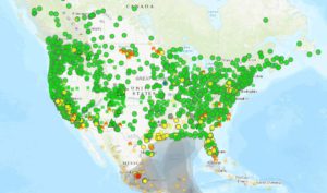
The first time you log in, you’ll see a map of North America, with a series of green, yellow, orange and red dots stretching across Canada, the U.S. and Mexico.
“You can zoom in on Iowa and you can see the monitoring sites that we have in the state, and the AQI is represented by a dot on the map,” Hutchins says. “It’s a colored dot and you can compare that to the AQI number.”
In recent years, Iowa’s air has been polluted by wildfires as far away as Canada. The next time it happens, Hutchins says the map will come in handy, as there are things Iowans can do to stay safe.
“It’s a good idea to limit outdoor activity, especially physical activity like exercising, that sort of thing,” Hutchins says, “if you are an individual that is susceptible to that type of impact.” He also suggests limiting your time near pollution sources — like busy roads. This is National Clean Air Week. There are sensors in the Clinton including one at the Chancy Park.
(image is the AirNow map)