
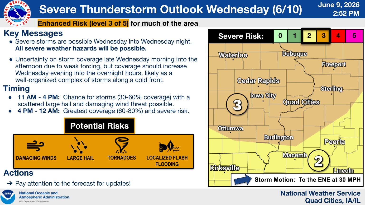
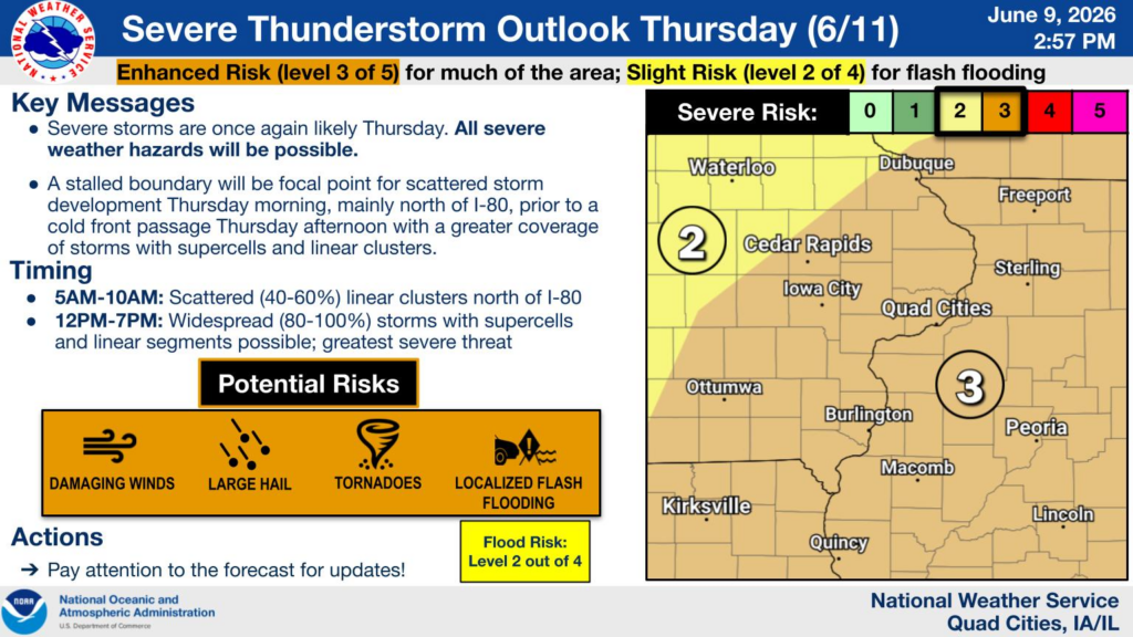
Numerous strong to severe storms will be seen Wednesday and Thursday
across the area. The Storm Prediction Center has an Enhanced, level
3 out of 5, risk each day for much of the area.
Two rounds of storms are possible on Wednesday. The first from 10 AM
to 4 PM. Damaging winds and hail are possible with the first round.
The more significant severe risk will be round two, roughly from 5
PM Wednesday to 2 AM Thursday. Initial storm development of
discrete storms is possible in the local area capable of
producing very large hail and strong tornadoes. It is also
possible these discrete storms form further west and evolve into
a line. This line would move through Wednesday evening into the
early overnight with a threat for damaging winds, potentially
over 70 mph, and spin-up tornadoes.
On Thursday another one or two rounds of severe storms is possible
with the threats of large hail, damaging winds and tornadoes.
Timing could be as early as late morning, but is more likely in
the afternoon before ending by early Thursday evening with the
passage of a cold front.